
Trumbull County ZIP Code Coverage
The authoritative countywide starting list is the Ohio Department of Taxation's County Rate-by-ZIP table. It identifies ZIPs with Trumbull County geography. It does not establish that an entire ZIP is inside the county, identify every neighborhood, or provide a complete post-office chart. An asterisk in the state table marks a ZIP that crosses county boundaries. For one address, use USPS rather than a map or general ZIP list.
| ZIP | Areas Covered | Post Office | Notes |
|---|---|---|---|
| 44402 | Trumbull County geography in the state table | Verify with USPS for the address | Postal coverage is not a city boundary |
| 44403 | Trumbull County geography in the state table | Verify with USPS for the address | Postal coverage is not a city boundary |
| 44404 | Trumbull County geography in the state table | Verify with USPS for the address | Postal coverage is not a city boundary |
| 44410 | Trumbull County geography in the state table | Verify with USPS for the address | Postal coverage is not a city boundary |
| 44417 | Trumbull County geography in the state table | Verify with USPS for the address | Postal coverage is not a city boundary |
| 44418 | Trumbull County geography in the state table | Verify with USPS for the address | Postal coverage is not a city boundary |
| 44420 | Trumbull County geography in the state table | Verify with USPS for the address | Postal coverage is not a city boundary |
| 44424 | Hartford postal label | USPS Hartford Post Office | Confirm exact delivery address with USPS |
| 44425* | Trumbull and Mahoning geography | Verify with USPS for the address | Cross-county ZIP in the state table |
| 44428* | Trumbull and Ashtabula geography | Verify with USPS for the address | Cross-county ZIP in the state table |
| 44429* | Mahoning, Portage, and Trumbull geography | Verify with USPS for the address | Cross-county ZIP in the state table |
| 44430 | Trumbull County geography in the state table | Verify with USPS for the address | Postal coverage is not a city boundary |
| 44437* | Trumbull and Mahoning geography | Verify with USPS for the address | Cross-county ZIP in the state table |
| 44438 | Trumbull County geography in the state table | Verify with USPS for the address | Postal coverage is not a city boundary |
| 44439 | Trumbull County geography in the state table | Verify with USPS for the address | Postal coverage is not a city boundary |
| 44440* | Trumbull and Mahoning geography | Verify with USPS for the address | Cross-county ZIP in the state table |
| 44444* | Mahoning, Portage, and Trumbull geography | Verify with USPS for the address | Cross-county ZIP in the state table |
| 44446 | Trumbull County geography in the state table | Verify with USPS for the address | Postal coverage is not a city boundary |
| 44450 | Trumbull County geography in the state table | Verify with USPS for the address | Postal coverage is not a city boundary |
| 44453 | Orangeville postal label | USPS Orangeville Post Office | Confirm exact delivery address with USPS |
| 44470* | Portage and Trumbull geography | Verify with USPS for the address | Cross-county ZIP in the state table |
| 44473 | Trumbull County geography in the state table | Verify with USPS for the address | Postal coverage is not a city boundary |
| 44481* | Warren postal region with Mahoning and Trumbull geography | Verify with USPS for the address | Do not equate Warren ZIP with county or city borders |
| 44482 | Warren postal region and Trumbull geography | Verify with USPS for the address | Confirm physical location with USPS |
| 44483 | Warren postal region and Trumbull geography | Verify with USPS for the address | Confirm physical location with USPS |
| 44484 | Warren postal region and Trumbull geography | Verify with USPS for the address | The Board of Elections Warren address uses this ZIP |
| 44485 | Warren postal region and Trumbull geography | Verify with USPS for the address | Confirm physical location with USPS |
| 44491* | Geauga, Portage, and Trumbull geography | Verify with USPS for the address | Cross-county ZIP in the state table |
| 44504* | Mahoning and Trumbull geography | Verify with USPS for the address | Cross-county ZIP in the state table |
| 44505* | Mahoning and Trumbull geography | Verify with USPS for the address | Cross-county ZIP in the state table |
The research did not find one official source that publishes a current post-office, neighborhood, PO-box, or unique-ZIP chart for every small portion of these ZIPs. The table intentionally leaves those unverified details out. A ZIP is postal geography, not a political boundary.
Trumbull County ZIPs Across Borders
Eleven ZIPs in the state table are marked as multi-county: 44425, 44428, 44429, 44437, 44440, 44444, 44470, 44481, 44491, 44504, and 44505. The underlying comparison is simple but important. The postal service routes mail through a ZIP, while the county and its cities, villages, and townships use legal jurisdictions. A county name in a postal result cannot decide which records office or local addressing authority applies.
Warren's 44481 through 44485 postal region illustrates the same issue. The state table identifies the region, but 44481 also carries a multi-county indicator. Preserve the full delivery address, the municipality or township, and the parcel identifier when research moves from a ZIP to a local record. That is especially useful in a county of 24 townships, six cities, and five villages.
USPS Confirms a Trumbull County ZIP
Use the USPS ZIP Code Lookup for the delivery ZIP attached to a specific mailing address. USPS is the authoritative check before a local search. The county's records should follow that validation, not replace it. The result can then be compared with the physical street location and the municipal or township context shown by local records.
See the official USPS ZIP Code Lookup before copying a ZIP into a research note.
The USPS tool confirms a delivery ZIP for one address, which is a narrower and safer question than assuming a whole neighborhood belongs to a ZIP.
Note: USPS verifies postal delivery information; the county Auditor and GIS provide the local parcel context that follows.
Finding Records from a Trumbull ZIP
A Trumbull County ZIP code directory is an address-verification route, not a county ZIP roster. The observed local tools do not offer a public ZIP-wide resident search. The Auditor advertises Parcel, Owner, or Address searching. The Recorder's PAXWorld index offers name, legal, and instrument searches. Ohio's individual voter lookup requires first name, last name, and county. Use the ZIP to verify a mailing address, then shift to the search mode documented by the county or state tool.
- Confirm the exact mailing address and ZIP with USPS, retaining the street spelling and postal city exactly as returned.
- Use the Trumbull County Auditor Property Search by address, owner, or parcel to identify the parcel and its situs details.
- Record the parcel number, legal description, subdivision terms, and current deed reference rather than relying on the ZIP alone.
- Use the Recorder PAXWorld index by known instrument, party name, or legal terms when a recorded document is needed.
- For a named registration check, use Ohio Voter Search with the required name and county, subject to the public-record limits.
Once a ZIP has narrowed the location to a specific street, use the Trumbull County streets reference for the address-focused parcel and deed chain. That route is more precise than treating a ZIP as an address index.
Trumbull County ZIP Search Modes
The local tools use different keys. None of the observed public modes turns a ZIP into a countywide people list. The raw county parcel layer contains situs and owner ZIP fields, but it is a technical ArcGIS service with filters for fields, geometry, distance, pagination, sorting, and output. It is not an ordinary resident-facing ZIP form. The table separates documented search modes from unsupported ZIP claims.
| Local tool | Documented search mode | ZIP role and limit |
|---|---|---|
| Auditor Property Search | Parcel, Owner, or Address | Use a confirmed address or known owner. No observed ZIP filter. |
| Recorder PAXWorld | Name, Legal, or Instrument | Use a party, legal description, or known reference. No observed ZIP filter. |
| Ohio Voter Search | First Name, Last Name, County | Individual registration tool, with a street-name narrowing prompt observed after a match. |
| County GIS parcel layer | Field and spatial service controls | Contains address-related fields but is not a normal ZIP-wide resident form. |
| USPS ZIP Lookup | Exact mailing-address verification | Confirms postal routing for an address before local records work. |
Ohio voter records have boundaries even where public access exists. Protected records, phone and email data, state identification numbers, Social Security numbers, and other restricted information are not part of a general lookup. A voter record can support a limited registration question; it cannot prove every person connected to an address.
Trumbull County ZIP Code Boundaries
A ZIP boundary can diverge from a city limit, township line, or county line. The county GIS records address updates in the 911 system, but local zoning offices assign new addresses in communities with zoning. Elsewhere, the local fire department or trustees do so, and GIS then updates 911. A historic and current address mismatch may therefore involve a changed 911 address, a different local authority, or a changed place label.
- ZIP
- A postal routing code used for mail delivery. It does not define a county, city, or parcel.
- ZIP+4
- An added delivery segment used by USPS to refine routing within a base ZIP. It is not a local jurisdiction.
- PO-box ZIP
- A ZIP assigned for post-office box delivery. The research does not identify which Trumbull ZIPs, if any, should be labeled this way.
- Unique ZIP
- A ZIP used for a single delivery destination or organization. No Trumbull unique-ZIP claim is made without an authoritative source.
- Carrier route
- A postal delivery route within a ZIP. It is not the same as a city boundary or a parcel map layer.
When a number changes across time, retain the situs address, legal description, parcel identification, municipality or township, and prior deed reference. Those fields are more durable than a postal label.
Situs and Mailing ZIPs Differ
Trumbull County parcel records distinguish a situs address, owner or taxpayer mailing address, and legal description. The situs is the physical parcel location. A mailing address is where tax correspondence goes. The legal description uses lot, block, subdivision, or metes-and-bounds language in a deed or parcel record. These are not interchangeable facts, even when the same base ZIP appears in more than one field.
The county tax-parcel layer lists separate field families for situs street, city, state, and ZIP; owner mailing street, city, state, ZIP, and country; parcel identifiers; legal description; and deed references. For historic work, compare the legal description and recorded document rather than forcing an old number to match a current ZIP.
Note: A tax mailing ZIP can be a useful correspondence clue, but it does not establish that the owner lives at the parcel.
Hartford and Orangeville Postal Checks
Two post-office anchors were documented directly. USPS lists the Hartford Post Office at 6893 State Route 305, Hartford, OH 44424-9800. USPS lists the Orangeville Post Office at 7401 Stateline Road, Orangeville, OH 44453-9800. These links confirm the listed office locations, but they do not define the full geographic area served by either ZIP.
Review the official Hartford Post Office listing for a documented postal anchor.
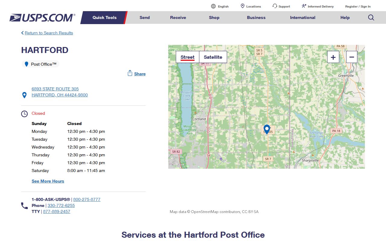
The Hartford listing supports the 44424 postal label in the coverage table while leaving exact address verification to USPS.
Review the official Orangeville Post Office listing for the other documented postal anchor.
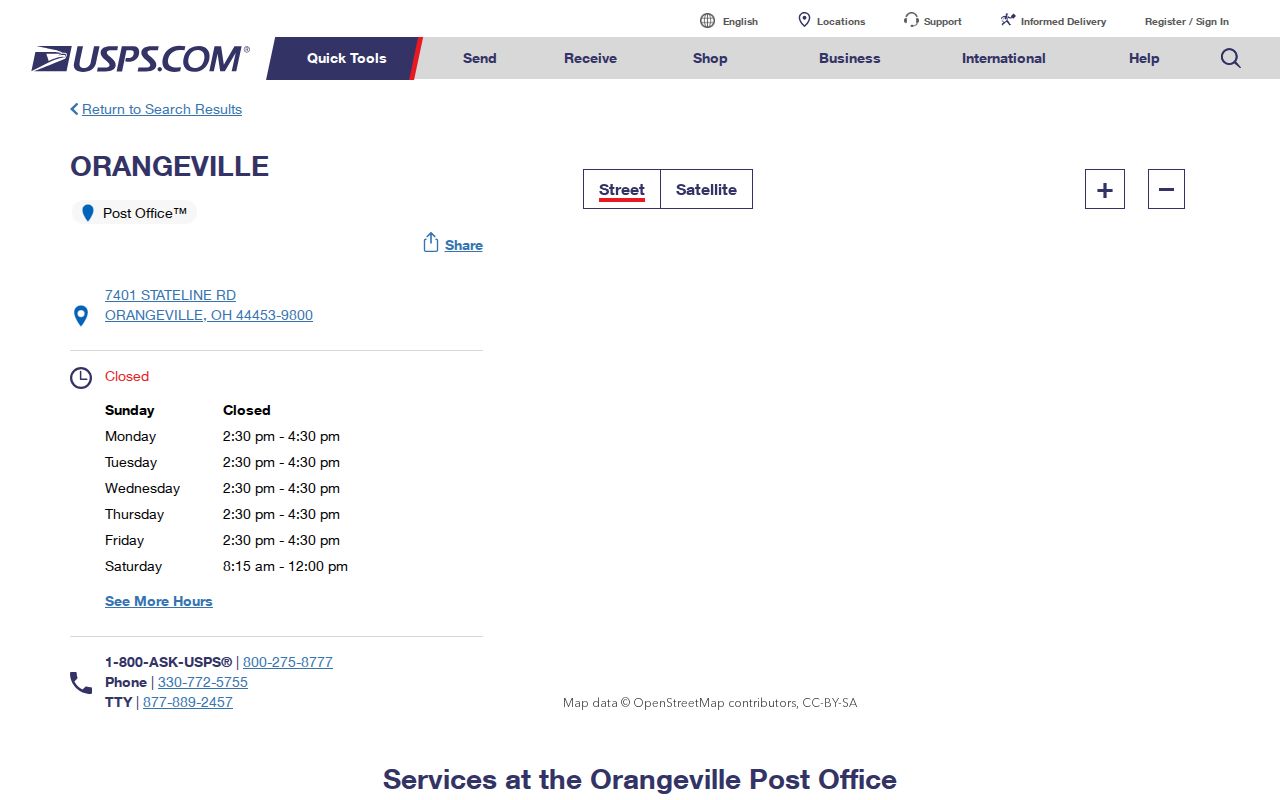
The Orangeville listing supports the 44453 postal label without claiming a complete local coverage map.
Older Trumbull County Address Labels
Postal research becomes harder when a historic address predates a current numbering pattern or uses a former subdivision name. WTCPL's 1918 atlas has maps and plates for lower townships, Warren city, and Morgandale Little Farms. The 1899 county atlas and earlier land-ownership maps add freeholder and place context. They can help bracket an address, but they are not current ZIP maps and should be paired with a legal description or plat record.
Trumbull Memory preserves a specific address-continuity clue: a 1900-01 location was later converted from 106 to 245 Tod Avenue. That is a useful local quirk to investigate with maps, deed references, and directory entries. It is not evidence that every Warren street was renumbered. A careful record trail retains the former number rather than silently replacing it with a modern ZIP-era address.